Wildfires seen from space: the Almería case
    The wildfireThe satellitesThe researchEmergency

    Wildfires seen from space: the Almería case

    From 9 to 11 July 2026, a wildfire in the Levante Almeriense was tracked almost in real time from satellites. Here is how 3Bee watches fire from space with six satellite sources, and the ongoing research to predict how a fire spreads.

    Read the article
    12/07/2026Of 3Bee, Niccolò Calandri, 3Bee
    104 Views
    12/07/2026Of 3Bee, Niccolò Calandri, 3Bee
    104 Views

    A wildfire seen from space

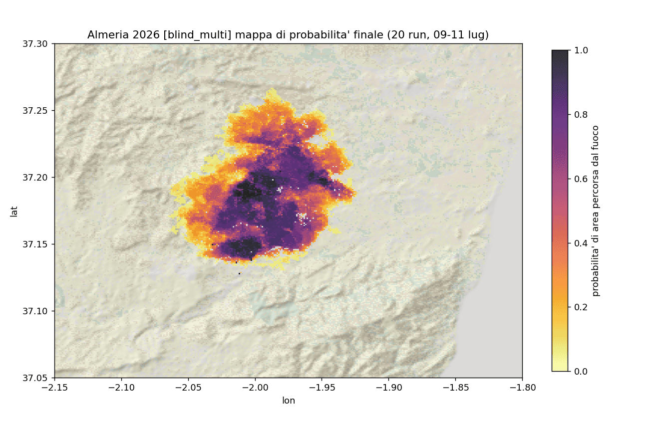
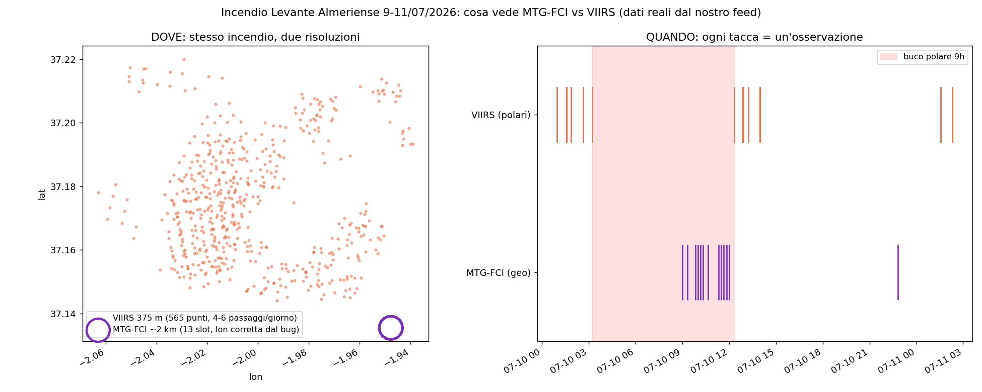
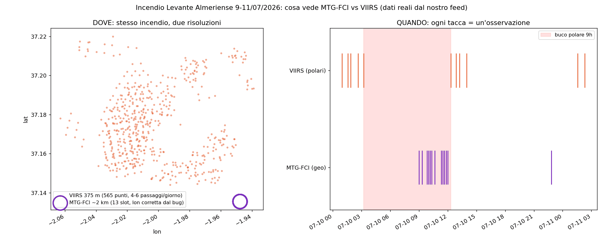
    Between 9 and 11 July 2026, a wildfire developed in the Levante Almeriense, in the province of Almería, Andalusia (the Los Gallardos area, around 37.16 N and -1.96 W). We were not on site, yet we could follow how it evolved almost in real time thanks to satellites. The first thermal detections in our feed appear on 9 July from 15:09 UTC. Activity grows to a peak on 10 July, then fades on the 11th. Over three days we recorded about 719 thermal detections, with a burned area estimated by satellites on the order of 3,000 hectares. The data also tell the weather story that makes an ignition dangerous, the so-called fire weather: wind around 18-20 km/h with gusts up to 32 km/h, relative humidity close to 24% (below the critical 30% threshold), about 14 days without rain and temperatures around 34 degrees. Combined, these conditions turn a spark into a front that is hard to contain.
    A wildfire seen from space

    How 3Bee satellite monitoring works

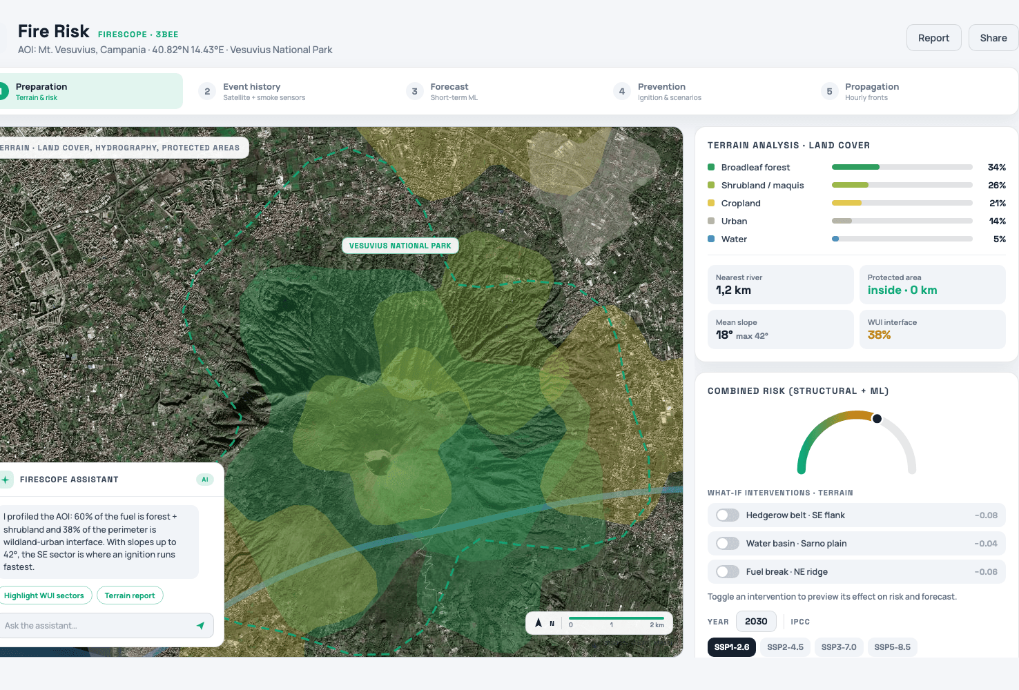
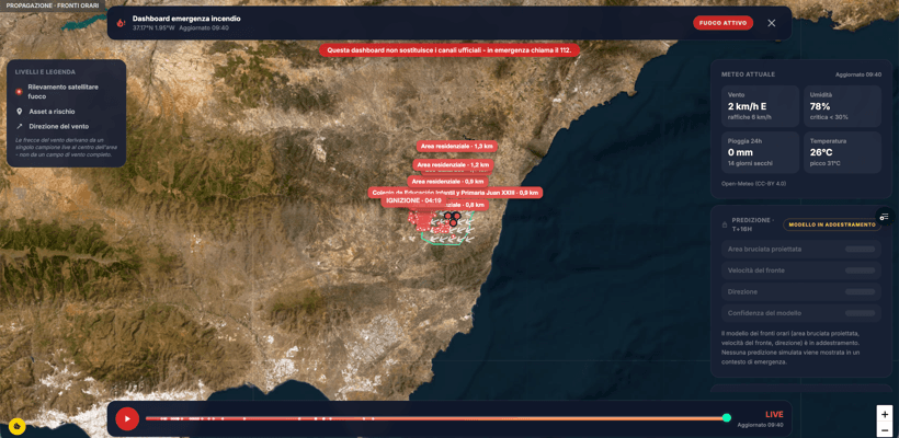
    To see fire from space, 3Bee combines six complementary satellite sources. The key is pairing two different families. On one side, the new-generation European geostationary satellite MTG-FCI: it observes Europe roughly every ten minutes, so it tells us precisely WHEN, though with a coarser view. On the other, the polar satellites, which pass only a few times a day but in much finer detail: the VIIRS sensors at 375-metre resolution aboard Suomi-NPP, NOAA-20 and NOAA-21, the classic MODIS and ESA's Sentinel-3 SLSTR. These tell us exactly WHERE. The geostationary one always sees but from afar; the polar ones see very well but at intervals: together they give a continuous, accurate picture. All these detections flow into the "Fire risk" section of the tools on ilovenatura.com, the FireScope rapid-response dashboard, which shows the fire live on a map and is free to consult.

    How 3Bee satellite monitoring works
    XNatura

    The frontier: predicting where fire will go

    Seeing where a fire is matters. Understanding where it is heading matters even more. That is why at 3Bee we are studying, on an experimental basis, a fire-spread simulation model. It is a cellular automaton, an approach from the same family as the Propagator model used by civil protection: the land is divided into many cells, and fire can pass from one to another based on physical factors such as terrain slope, wind, fuel moisture and vegetation type. In retrospective tests on fires that already happened, such as Vesuvius in 2017 and this one in Almería, the model reproduces the order of magnitude of the burned area and the direction of spread, with margins of error. It is important to be honest: this is a research model, not an operational forecasting tool. The work continues precisely to understand its limits and, one day, to bring it closer to real use.

    The frontier: predicting where fire will go

    What you can do

    Satellite monitoring makes visible to everyone something that used to stay within specialised centres. Anyone can open the "Fire risk" section on ilovenatura.com and see live detections, get a sense of the situation in an area and better understand a phenomenon that, with ever hotter and drier summers, affects us all closely. One important reminder, though: these tools are for observation and research, not for managing the emergency. If a fire is under way, the reference is always and only the official channels, the single emergency number 112 and civil protection. The dashboard does not replace them. We will keep telling how satellite technology helps us protect forests and biodiversity better, and where our research on predicting fire spread stands.

    What you can do
    XNatura
    12/07/2026Of 3Bee, Niccolò Calandri, 3Bee
    104 Views
    Newsletter
    newsletter
    Subscribe to the Blog about bees and biodiversity