A wildfire seen from space
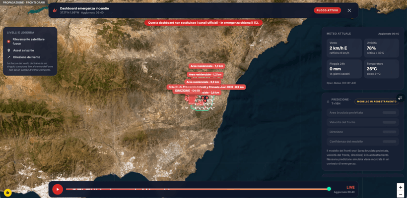
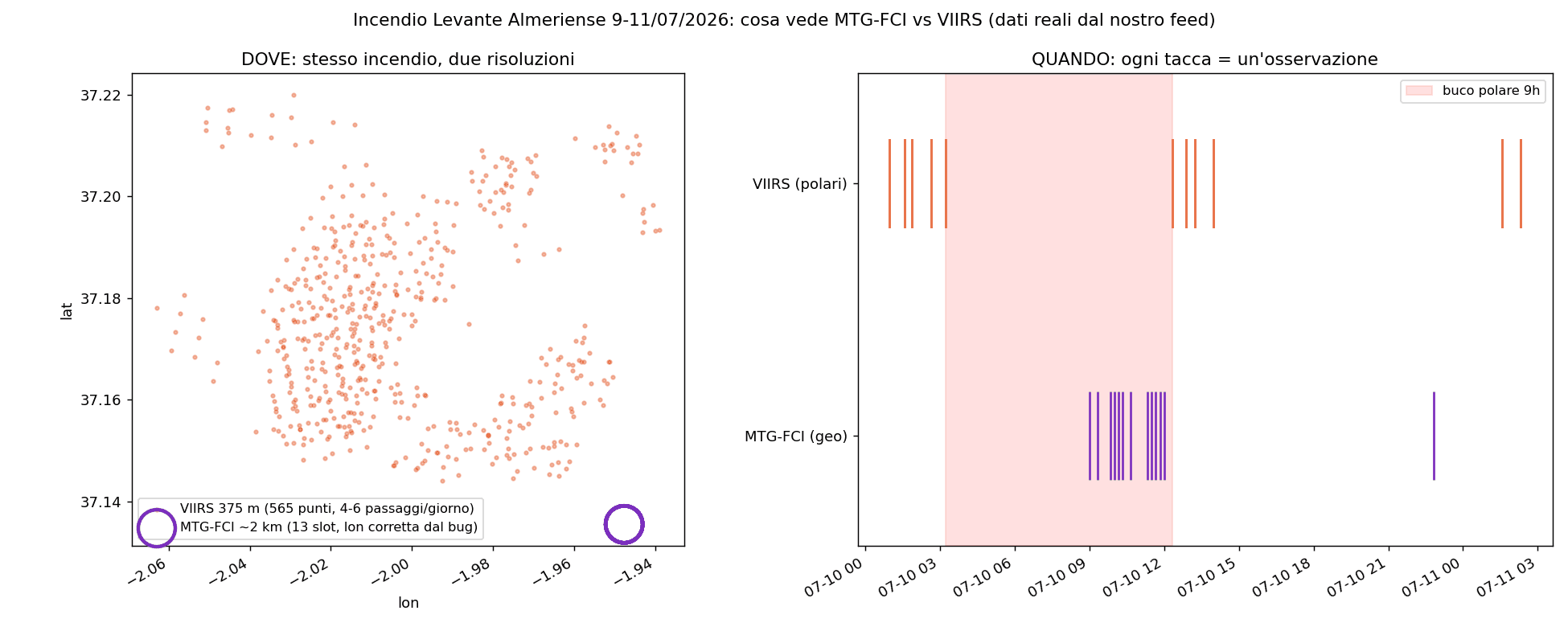
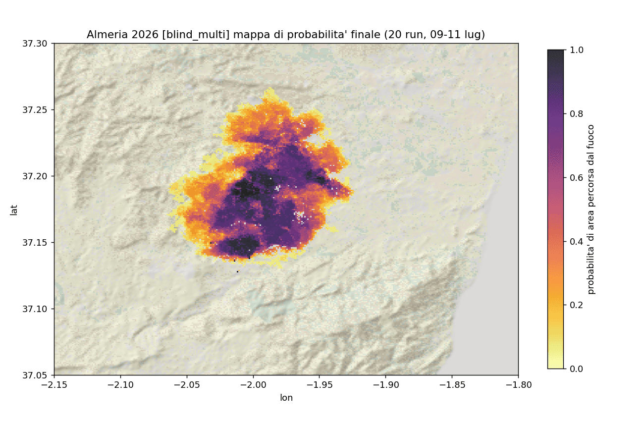
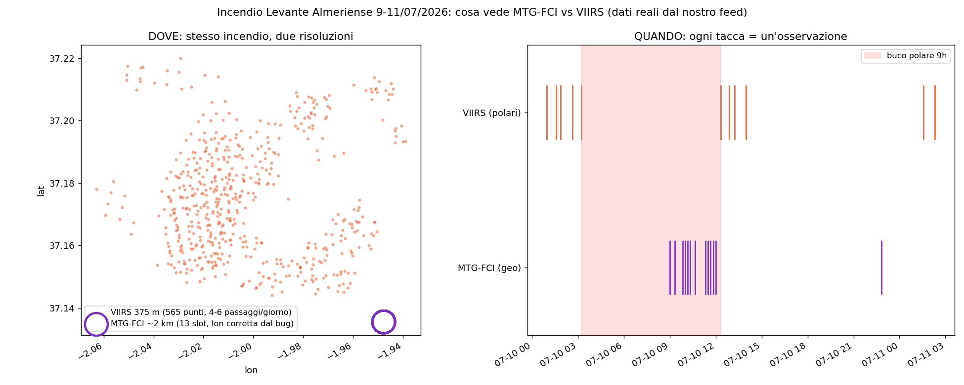
Between 9 and 11 July 2026, a wildfire developed in the Levante Almeriense, in the province of Almería, Andalusia (the Los Gallardos area, around 37.16 N and -1.96 W). We were not on site, yet we could follow how it evolved almost in real time thanks to satellites. The first thermal detections in our feed appear on 9 July from 15:09 UTC. Activity grows to a peak on 10 July, then fades on the 11th. Over three days we recorded about 719 thermal detections, with a burned area estimated by satellites on the order of 3,000 hectares. The data also tell the weather story that makes an ignition dangerous, the so-called fire weather: wind around 18-20 km/h with gusts up to 32 km/h, relative humidity close to 24% (below the critical 30% threshold), about 14 days without rain and temperatures around 34 degrees. Combined, these conditions turn a spark into a front that is hard to contain.