Monitoring nature in infrastructure facilities
    IntroductionXNaturaEU RoadmapBenefits

    Monitoring nature in infrastructure facilities

    Virginia Castellucci, Lucrezia Palma, Giorgio Puzzarini (XNatura) and Ilaria Napoli (A35 Brebemi Aleatica) discuss how the XNatura platform helps infrastructure companies assess environmental impacts, ensure compliance, monitor biodiversity, enhance resilience, with a demo and practical case study.

    Read the article
    06/10/2025Of 3Bee, 3Bee
    85 Views
    06/10/2025Of 3Bee, 3Bee
    85 Views

    Monitoring environmental impacts in infrastructure

    In this article, Virginia Castellucci (Head of Sustainability, XNatura), Lucrezia Palma (Sustainability Specialist, XNatura), Giorgio Puzzarini (Sustainability Specialist, XNatura) and Ilaria Napoli (Head of Environment and Sustainability, A35 Brebemi Aleatica) discuss how the XNatura platform supports companies in the infrastructure sector in performing better environmental assessments, aligning with the latest sustainability frameworks. The session highlights practical solutions for monitoring environmental impacts and navigating the EIA permitting process efficiently. A live demo showcases real-world use cases, demonstrating how the platform supports long-term resilience, mitigates infrastructure impacts on biodiversity, and ensures compliance with evolving regulatory requirements. Finally, the session concludes with a practical case study of A35 Brebemi Aleatica.
    What is XNatura?

    XNatura is a leading environmental platform focused on biodiversity monitoring and protection, offering technological solutions for assessment, monitoring, regeneration, and dissemination. With partnerships across over 15 research centers and scientific institutions globally, XNatura is present in more than 25 countries. The platform has over 500 customers and has deployed more than 5,000 IoT devices worldwide, currently mapping over one million hectares of land. As an in-house division of 3Bee, XNatura specializes in managing and monitoring environmental risks through data-driven insights, utilizing technologies like remote sensing, lab analysis, field sensors, and on-site surveys. The platform serves a wide range of users, including companies, municipalities, and natural parks, providing essential tools for decision-makers to effectively manage their environmental impacts.

    XNatura

    EU Roadmap on Nature Credits

    An update on the EU roadmap for Nature Credits has been released. The initiative aims to establish a standardized system that generates value from investments in nature, promoting a nature-positive economy in which businesses treat natural resources as strategic assets. The system is structured around the certification of projects that deliver measurable benefits to nature, followed by a crediting phase in which Nature Credits are issued and can be traded. XNatura participates in the expert group developing this system, contributing to the methodology for carbon farming with biodiversity co-benefits. The broader objective is to create a framework for trading Nature Credits both across Europe and globally. XNatura supports the Nature Credits development through its natural intelligence division, monitoring and protecting natural environments for companies, municipalities, and parks, employing remote sensing, laboratory analysis, ground sensors, and field surveys.

    Platform benefits for the infrastructure sector

    The XNatura platform offers several benefits for the infrastructure sector. First, it transforms monitoring data into structured metrics in a digital format. Second, it enables scenario analysis for plant implementation, allowing for before-and-after assessments of infrastructure facilities' impact on nature. Third, it provides benchmark and target verification, helping users position themselves within the sector and set goals. Fourth, it facilitates risk and dependencies prioritization, identifying at-risk sites or supply chain vulnerabilities. The platform is compliant with major standards like TNFD and ESRS, and it streamlines bureaucratic processes by generating reports for stakeholder communication and project management.

    XNatura

    Infrastructures: key for the transition

    The infrastructure sector is a significant contributor to greenhouse gas emissions, yet it also presents a powerful opportunity for positive change, with 92% of Sustainable Development Goals (SDGs) achievable through targeted investment. However, the sector also has substantial environmental impacts, including habitat changes, pollution from materials and chemicals, and noise and light pollution. Here are some key numbers: infrastructure development is the primary cause of habitat fragmentation globally; approximately 60% of major rivers have been altered by dams and canals; in Europe, 99% of the population lives under light-polluted skies, negatively impacting both human population and nocturnal birds.

    3Bee

    Environmental risks and related tools in the platform

    The sector is also susceptible to environmental risks, including temperature, wind, water, and solid mass-related issues. Soil degradation, erosion, avalanches, and landslides are all physical risks that the infrastructure sector must address. The XNatura platform features a section dedicated to these risks, offering an overview of monitored sites, the number of assets potentially at risk, and critical sites based on selected risk layers. It also provides a visualization of monetary risk, with a rating from A to E for sites most impacted by specific risks like flooding, drought, and wind. The platform further allows for visualizing risk distribution across sites and tracking general trends over time, with ongoing development for site-specific risk details and projections based on IPCC scenarios.

    Sustainability frameworks: SDGs and EU Taxonomy

    The normative and policy framework for the infrastructure sector is shaped by several international and European initiatives, including the UN 2030 agenda, the EU taxonomy, the EU biodiversity strategy, TNFD, and ESRS, alongside specific certifications. The SDGs, particularly those concerning industry, innovation, infrastructure (9), sustainable cities and communities (11), and climate action (13), are crucial. The EU Taxonomy, a regulatory classification system, identifies environmentally sustainable economic activities under EU law, including new infrastructure construction and ownership. For an activity to be taxonomy-aligned, it must substantially contribute to at least one objective, do no significant harm, and comply with minimum social safeguards like human rights standards.

    A focus on biodiversity: CBD & GBF

    Regarding biodiversity, key normative frameworks include the Convention on Biological Diversity and the Global Biodiversity Framework. These provide broad guidance for integrating biodiversity conservation into project planning in the infrastructure sector. Similarly, the EU Biodiversity Strategy, the Natural Restoration Law, and the Habitats and Birds Directive are crucial. Given the infrastructure sector's significant impact on habitat degradation, compliance with these regulations promotes ecosystem restoration, reduces legal risks for companies, and supports EU environmental and climate goals.

    CSRD and ESRS

    The Corporate Sustainability Reporting Directive (CSRD) is currently undergoing changes. Companies are advised to begin collecting data and reporting on nature, biodiversity, and ESG aspects without waiting for mandatory compliance, as earlier adoption benefits businesses. The European Sustainability Reporting Standards (ESRS), particularly E4 (Biodiversity and Ecosystems), are vital for evaluating and quantifying environmental and social impacts using specific KPIs, fulfilling disclosure requirements, and integrating ESG practices into business strategies. They also enhance stakeholder communication, credibility, and access to capital. ESRS mandates considering double materiality, acknowledging that biodiversity loss and ecosystem degradation pose risks and opportunities for the sector.

    TNFD and the LEAP approach

    The TNFD (Taskforce on Nature-related Financial Disclosures) is an important international framework that assists companies in identifying and managing their impacts on ecosystems and biodiversity through the LEAP (Locate, Evaluate, Assess, and Prepare) approach. This structured approach helps companies develop a strategy for reporting on biodiversity and nature, including preparing reports after the initial assessment. XNatura adopts this approach for its environemntal platform and structured methodology.

    Environmental certifications: BREEAM and LEED

    Environmental certifications like LEED (Leadership in Energy and Environmental Design) and BREEAM (Building Research Establishment Environmental Assessment Method) are significant in the sector. LEED (Leadership in Energy and Environmental Design) promotes a general sustainability-oriented approach across areas like water savings and CO₂ emissions reduction. BREEAM (Building Research Establishment Environmental Assessment Method) is more structured, with specific categories such as energy, water, health and well-being, waste, and innovation, requiring a third-party certification process.

    The Envision protocol

    For the infrastructure sector specifically, the Envision Protocol is the first sustainability rating system for infrastructure projects. It provides a comprehensive, adaptable framework for businesses, designers, public administrations, and citizens to evaluate and improve the long-term ESG impacts of infrastructure development. The rating system includes phases like "improved" (above-average performance), "superior," "conserving," and "restorative" (improving natural and social systems). Evaluating ESG impacts helps achieve sustainability goals, gain public recognition, facilitate stakeholder engagement, secure community approval, inform investment decisions, and promote efficient, high-performance, and environmentally beneficial solutions.

    Environmental Impact assessment

    Environmental Impact Assessment (EIA) is crucial for minimizing the impact of infrastructure and other major projects. It is a systematic process that assesses environmental impacts before project approval, particularly for dams, solar power plants, railways, motorways, and express roads. Project developers must provide a report to the approval authority, including project description, localization, design, size, potential significant effects, reasonable alternatives, and measures to avoid, prevent, reduce, and offset environmental impacts. The EIA process helps improve projects and address negative impacts on nature. XNatura's platform assists in developing EIAs, adhering to ESRS standards and the TNFD LEAP approach.

    The EIA process with XNatura

    The first phase of the Environmental Impact Assessment is screening, where XNatura utilizes geospatial and environmental data of the site to classify land use and determine if the project is in high conservation value or protected areas. In the second phase, scoping, XNatura identifies key environmental impacts by providing data on local conditions collected through remote sensing, sensors, on-field surveys, and lab analysis, all consolidated into a single platform. The report preparation phase requires component characterization, impact assessment, and mitigation activities, with all EIA requirements integrated into the report provided after the assessment. This report is valuable for public consultation and gaining approval from local communities, environmental groups, and authorities.

    Decision-making and monitoring

    During the decision-making phase, XNatura assists decision-makers by providing essential tools required by the EIA, such as comprehensive reports, risk assessments, scenario analyses, and predictive models. The final phase, monitoring and compliance, involves continuous project oversight. For this, XNatura utilizes IoT bioacoustic sensors like Spectrum and Birdy to track pollinators and birds, camera traps for capturing mammal images and videos, Polly X for air quality analysis (PM1.0, PM2.5), and Hive Tech, an IoT system dedicated to assess the health status of a beehive, and indirectly of the surrounding environment.

    Overview section

    Upon accessing the XNatura platform, users are presented with an overview map displaying all sites of a hypothetical company. Clicking on a site allows direct access to its specific section. Key numbers include production processes, extension, and number of sites. The overeview of impacts, dependencies, and risks highlighted 20 sites with direct biodiversity impact, 3 with protected areas inside, and 27 under hydrogeological risk. Related to this, the platform offers a specific risk-dedicated section.

    Risk overview

    In the "Risks Overview" section it is possible to select an year and the future IPCC scenario. Based on these data, the XNatura platform visualizes main risk ratings categorized by climate, water, pollution, biodiversity, geological, and sea. A table classifies each site with a rating from A to E (worst case), including an economic value in euros if data is available. The risk rating (letter) represents the overall risk, calculated as probability multiplied by intensity and sensitivity. This analysis enables comparison of environmental risk exposure between locations and quantifies potential financial impact for each risk category.

    Specific risk analysis

    A second table offers a detailed analysis of a selected risk, such as climate change, showing physical risk ratings, sensitivity, impact level, impact risk, and damage factor for each site. This data helps quantify economic exposure to risk by calculating both absolute and percentage values of assets at risk across different locations. The Natura environmental platform also provides multiple graphical visualizations of risk distribution and economic evaluations by risk level, enhancing decision-making.

    The prioritization matrix

    Returning to the overview, the matrix is a valuable tool for prioritizing actions after evaluating risks, impacts, and dependencies. Users can compare different parameters on x and y axes, such as the Mean Species Abundance (MSA) of a site and its distance to protected areas, among many other Key Performance Indicators. This allows for easy identification of relationships between parameters. For instance, in a scenario involving environmental impact assessment permitting issues, one could compare MSA of sites near protected or sensitive areas to prioritize actions.

    Site specific section: Locate and Evaluate

    Once a specific site is chosen, such as the Tirana Airport, the platform's dedicated section begins with a map, adhering to the TNFD’s LEAP (Locate, Evaluate, Assess, and Prepare) approach. The "Locate" phase provides geographical data, a brief description of the area, land use, production process, site activity, and regulatory context. This information is editable by both XNatura strategists and authorized users. The platform highlights the site's relationship with climate and nature, including status, impacts, and risks. The Impacts and Dependencies section presents a table outlining impacts linked to each production process. This table is automatically generated using the ENCORE database. Users can modify values for intensity, reach, and irremediability of impacts or dependencies if they don't match reality. XNatura strategists can again assist with these tools.

    Layers in the map

    Returning to the map, various layers and KPIs can be used to manage data. Layers include the site perimeter and land cover, showing structures, grasslands, and open spaces for an airport. The protected areas layer displays nearby protected zones, allowing for the creation of an ecological network. Hydrological risk is another important layer, indicating risk levels (e.g., level four for the Tirana Airport, signifying a high-risk area). The extreme events layer shows the site is in a high-risk flood-prone area, displaying past flood examples.

    Risk KPIs section

    KPI metrics are at the core of the platform, with all data aligned with major frameworks such as ESRS and TNFD. The microclimate section analyzes climate change, revealing a significant temperature increase of 1.2 degrees at the site, with concerning future projections. Precipitation trends show a substantial 47% increase, a critical data point for an area prone to flooding. The risks section details the very high probability of major events for Tirana Airport, as indicated by the site's score (D). This can be compared to the industry benchmark. As always, future projections can also be compared with past events, in this case floods and earthquakes. Being in a flat area, the site does not present issues with landslides and erosion. Other relevant KPIs include soil temperature.

    Biodiversity metrics

    The Mean Species Abundance (MSA) is a crucial KPI for biodiversity, indicating the diversity of animal and plant species compared to an untouched natural state (ranging from 0 to 100). The Tirana Airport's biodiversity levels are very low compared to benchmarks and control areas, indicating a serious issue. Moreover, for an airport monitoring bird species and their behavior is critical, because they can directly affect airport operations. The proximity to protected areas, shown by the "Protected areas" KPI, positively influences local biodiversity but requires greater attention due to potential bird presence. Three at-risk species have been identified in the area.

    Survey and Census Section

    The "Survey and Census" section collects data from direct observations, including those from citizen science platforms like Biodiversa and iNaturalist. For larger fauna, camera traps are used to capture images and videos of animals such as wild boars and wolves. XNatura's specialized sensors directly monitor various animal species, with a focus on avian populations. A central element for bird monitoring is Birdy, a bioacoustic sensor that recognizes and differentiates avian species through their vocalizations. This combination of approaches offers a comprehensive picture of biodiversity for effective conservation strategies.

    Bioacoustic sensors for pollinators, biodiversity monitoring

    This bioacoustic sensor concept also applies to invertebrates, particularly pollinators, which are crucial bio-indicators for permitting processes and increasing biodiversity levels (MSA) to obtain EIA approval. The Spectrum sensor, designed for pollinators, works by picking up the buzzing sounds of insects and classifying them into clusters, rather than species, to understand overall biodiversity levels. The sensor measurement section provides a graph showing the number of pollinators during a selected period of time, correlated with temperature and precipitation data, to analyze biodiversity behavior at the site.

    A35 Brebemi Aleatica: case study presentation

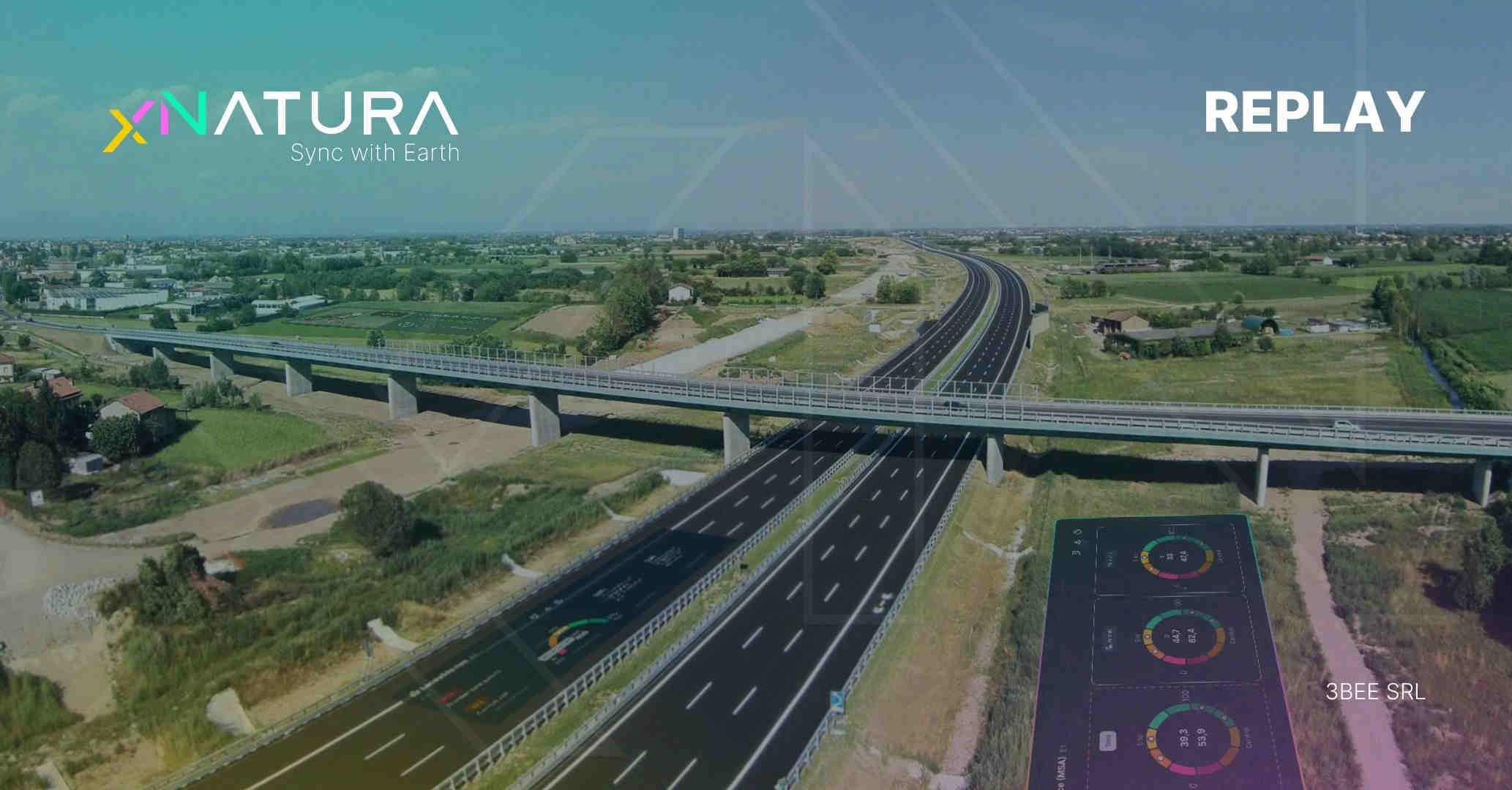
    Brebemi Aleatica has adopted an innovative approach to protect biodiversity along the A-35 highway, using remote sensing technology for environmental monitoring and establishing a dedicated biodiversity oasis along the route. The company manages a 62-kilometer highway connecting Milan and Brescia in Northern Italy. Since its construction, Brebemi has prioritized minimizing environmental impact, enforcing protection measures, and engaging with local communities. Both mandatory and voluntary initiatives are implemented to mitigate the infrastructure’s negative impacts and foster collaboration with local stakeholders. The company’s efforts are focused on creating infrastructure that is both safe and sustainable, combining technological monitoring with environmental responsibility.

    Biodiversity as a pillar

    The project, developed in collaboration with the scientific partner XNatura, emphasizes the importance of biodiversity and its restoration, particularly along linear infrastructures such as highways. Biodiversity is considered essential by Brebemi not only for the environment but also for human well-being, providing food, clean air and water, energy, and raw materials - resources that are critical for the economy. It also plays a key role in addressing climate change by supporting ecosystem restoration and helping to prevent desertification.

    The A35 Brebemi Aleatica project

    Recognizing the problem of biodiversity loss, Brebemi sought solutions within its motorway context. The company identified many unused areas along the linear infrastructure, as potential sites for biodiversity restoration. The core idea is to integrate restoration with human infrastructure and activity, acknowledging that all human activities and infrastructure impact ecosystems. Brebemi is attempting to address this issue by restoring unused areas belonging to its operators. In 2023, with XNatura's support, the first Biodiversity Oasis was established in a seven-hectare area between motorway junctions near Milan in Northern Italy.

    Technologies for monitoring nature

    The Oasis project comprises four beehives equipped with Hive-tech technology, one IoT sensor for monitoring wild pollinators, 105 nectar-producing plants, two avifauna monitoring devices, and half a hectare of nectariferous meadow. The project focuses not only on planting vegetation or installing beehives but also on scientifically assessing their impact. Monitoring evaluates the overall quality of the surrounding environment, rather than focusing solely on individual hives or trees. Technological tools, implemented in collaboration with XNatura, support this process through satellite imagery integrated with artificial intelligence, acoustic sensors combined with computational models, and other IoT systems that track key parameters of the bee population and the broader ecosystem. The collected data is used to inform strategies for enhancing biodiversity indices and guiding the planning of future conservation activities.

    Replicability of the approach

    The ultimate objective is not limited to creating a single Oasis, but to establish a replicable pilot model along the infrastructure. This approach is quantitative and scientific, assessing the specific ecological and environmental characteristics of each site. Data collected through satellite imagery, AI-driven models, acoustic sensors, and IoT devices informs evidence-based interventions, including plant selection, hive placement, and habitat design. The methodology can be adapted to different ecosystems and regions, providing a scalable framework to enhance biodiversity along linear infrastructure.

    White paper and next events

    As a reminder, the white paper with more insights on the infrastructure sector is available for download. It provides valuable information for those interested in this field. It offers a practical, data-driven roadmap to equip professionals with practical solutions to monitor their environmental impact and effectively navigate the EIA permitting procedure through actionable data and real-world case studies. You will find: XNatura IoT sensors and technologies for biodiversity monitoring; Impacts and risks related to nature: why sustainability is key for the sector; The normative framework linked to the infrastructure projects approval: EIA, EMP, environmental certifications, Envision protocol; How XNatura can support the EIA process, providing scientific and comparable metrics (CSRD and TNFD compliant). Learn from real case studies: A35 Brebemi Aleatica, CONCESSIONI AUTOSTRADALI VENETE - CAV.

    06/10/2025Of 3Bee, 3Bee
    85 Views
    Newsletter
    newsletter
    Subscribe to the Blog about bees and biodiversity