Flooding in Cogne: hydrogeological risk analysis
    CogneFloodsRischioAnalysis 3Bee

    Flooding in Cogne: hydrogeological risk analysis

    Following the recent flooding in Cogne and Valle d'Aosta, the 3Bee team carried out a hydrogeological risk and land use analysis to understand the events and their causes. Find out more in this article.

    Read the article
    08/07/2024Of 3Bee, Lisa Santillo
    657 Views
    08/07/2024Of 3Bee, Lisa Santillo
    657 Views

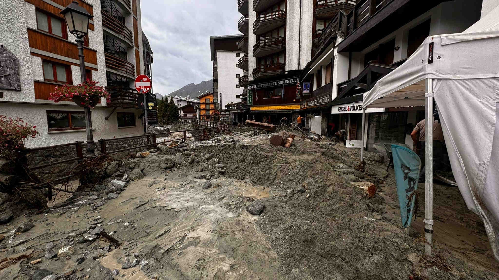
    Disaster in Cogne: flooding hits Aosta Valley

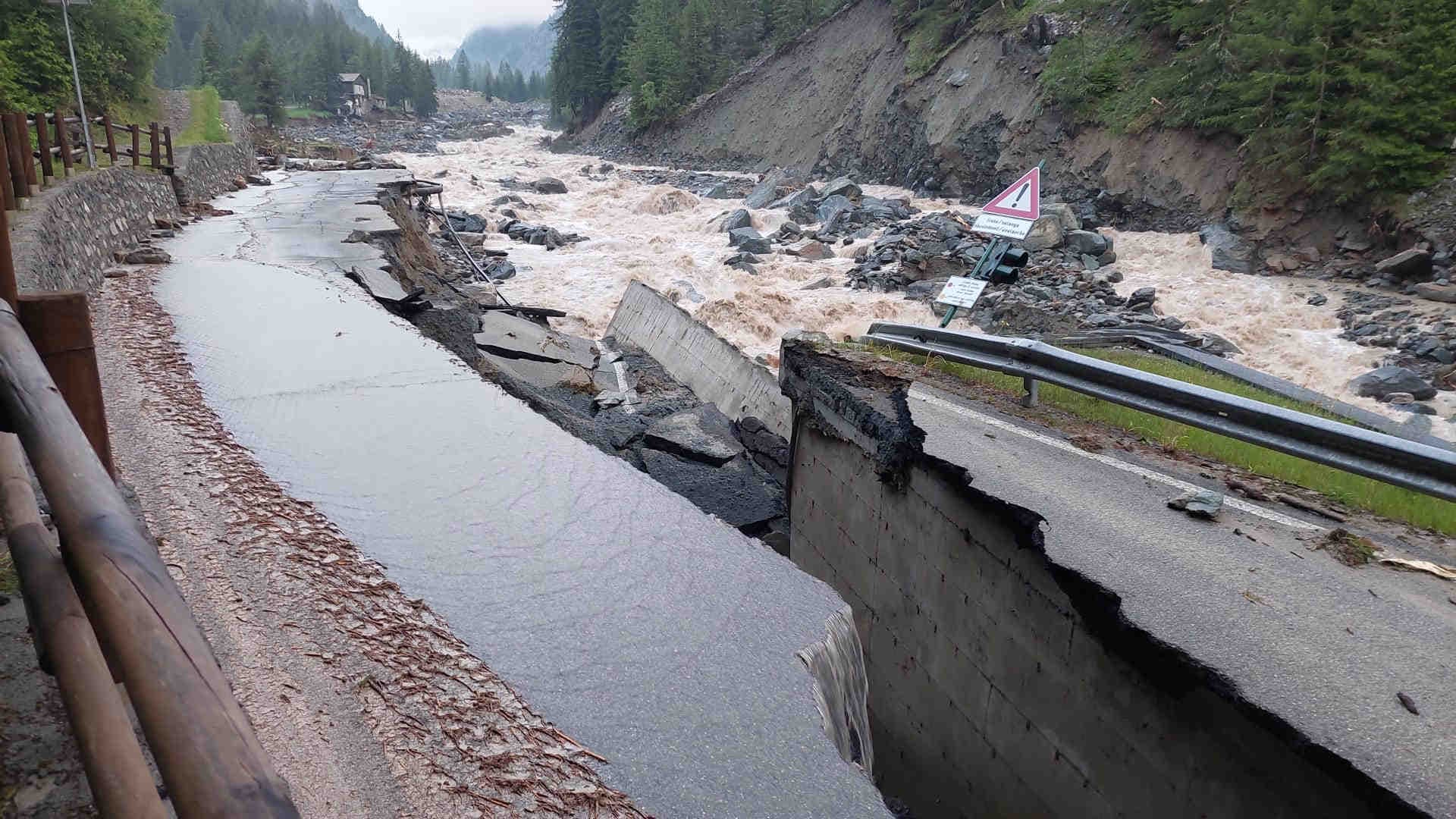
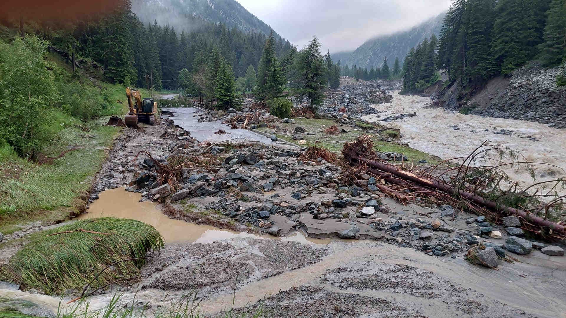
    Cogne, the picturesque alpine resort in the Aosta Valley, was one of the areas most affected by the flood that hit the region between 29 and 30 June 2024. This extreme climatic event caused extensive damage to the electricity network, aqueduct and infrastructure, interrupting regional road 47 at three different points due to the flooding of the Grand Eyvia stream, and also compromising the Valnontey municipal road. The balance of this environmental disaster is dramatic: flooded houses, uprooted roofs, entire hamlets isolated and dozens of vehicles damaged by hail. In addition, as many as 1,769 tourists stranded in Cogne were evacuated. Among the areas affected by the bad weather last weekend was not only Valle d'Aosta, but also Piedmont, where 347 firefighter interventions were recorded in just two days.

    Image: Regione Valle d'Aosta - Facebook
    Alluvione Cogne

    Floods and hydrogeological risk: impacts and causes

    Flood events and floods occur when water overflows normally dry land. Floods can occur due to the overflowing of rivers, lakes or oceans and are often caused by heavy rainfall, rapid snowmelt, breaching of dams or dikes, or a storm surge from a tropical cyclone or tsunami in coastal areas. The hydrogeological risk refers to the possibility of such events occurring and causing damage, considering the vulnerability of an area to these natural disasters. It depends not only on the frequency and intensity of meteorological and hydrological events, but also on the geological, morphological and soil use characteristics of an area.

    Image: Regione Valle d'Aosta - Facebook
    Cogne alluvione
    XNatura

    Hydrogeological risk measurement

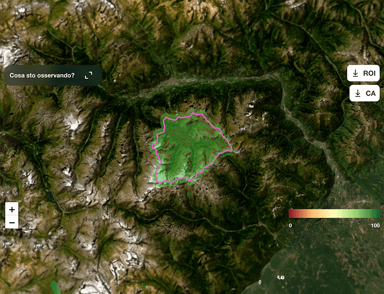
    Thanks to data on floods that have occurred in the past years from 1985 to the present, collected by the Global Active Archive of Large Flood Events, it is possible to associate a flood risk (flood risk) with each of the world's watersheds. The flood risk is calculated by counting the number of flood events that have occurred in the past for each watershed weighted according to the severity of damage to structures and people. This indicator, with a value from zero to infinity, is then divided into 5 risk classes, from lowest to highest depending on its value.
    Cogne analisi 3Bee

    Hydrogeological risk in Cogne: the 3Bee team's analysis

    Following the flooding in Valle d'Aosta, the 3Bee team analysed the hydrogeological risk of Cogne, based on the above methodology. With a score of 3 out of 5, Cogne's hydrogeological risk was found to be medium. In the last forty years, the intensity and severity of extreme weather events in the Municipality of Cogne is 8: there have been 8 significant flood events that have caused damage, even minimal, within its watershed. This figure emerges in a context of considerable biodiversity, as Cogne is located between two protected areas and therefore of fundamental importance for the conservation of biodiversity. The MSA (Mean Species Abundance) of the site is high, reflecting the rich variety and good conservation of the local ecosystem.
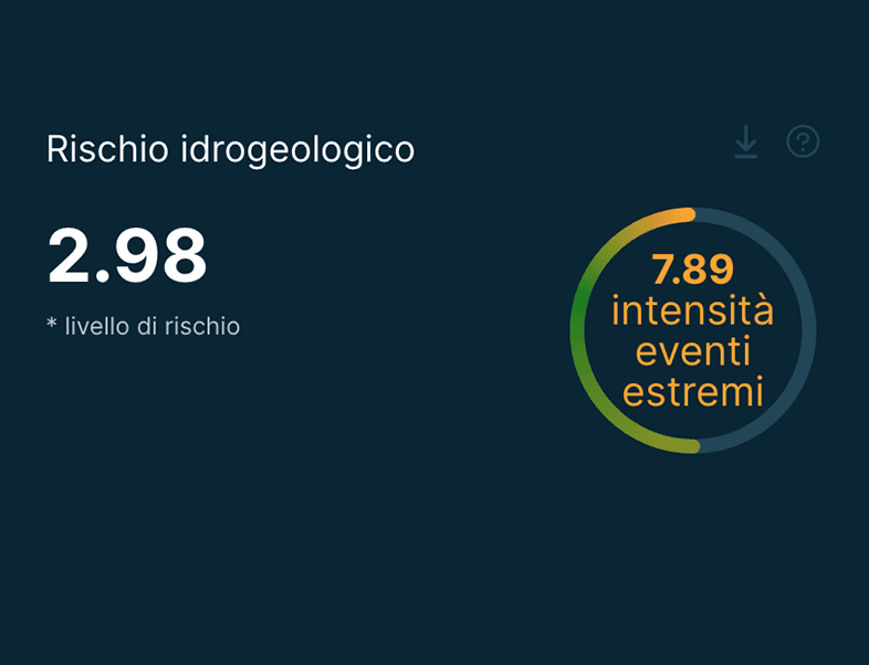
    Rischio idrogeologico Cogne
    XNatura

    Flooding in Cogne: a consequence of climate change

    Contrary to what one might imagine, the recent flooding does not result from environmental mismanagement, but is a direct consequence of climate change. With an average climate change of 2.5 degrees over the last four years, Cogne significantly exceeds the global warming limit set by the United Nations. This temperature increase underlines the region's increasing vulnerability to extreme climate events, drawing attention to the need to adopt effective local adaptation and mitigation strategies to address these environmental challenges and improve climate resilience.
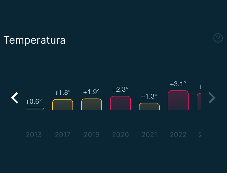
    Variazione climatica Cogne
    3Bee

    Impacts of the 2.5 degree climate change

    The average climatic variation of 2.5 degrees over the last four years means that climate instability is very strong in Cogne. This means that extreme events will be increasingly strong and frequent, even in those areas where man has not damaged or altered the environment. This phenomenon highlights the urgency of revising land management strategies to increase climate resilience and prevent future damage, with the aim of ensuring safety and environmental sustainability in the long term.
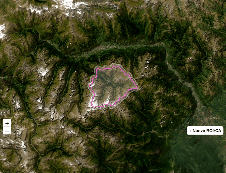
    Analisi rischio idrogeologico Cogne 3Bee

    Prioritisation of protective works

    For this reason, the prioritisation of protection works can no longer be based exclusively on hydrogeological risk, where priority levels are mainly classified with scores of 4 and 5. It is also necessary to include areas with scores of 3, if these show strong climatic variation. The prioritisation of protection works will therefore be <climatic as well as hydrogeological, integrating the risks resulting from climatic variations into the assessment criteria to ensure more effective and resilient protection of the Cogne territory.

    08/07/2024Of 3Bee, Lisa Santillo
    657 Views
    Newsletter
    newsletter
    Subscribe to the Blog about bees and biodiversity

    Frequently Asked Questions

    Do you have any doubts or other curiosities about this article? Here you will find some insights